Are you headed to Disney World for the MLK Holiday Weekend? We have an update on the weather forecast for this weekend that now has some severe weather chances to keep an eye out for.
Crowd Levels Increasing For The Weekend

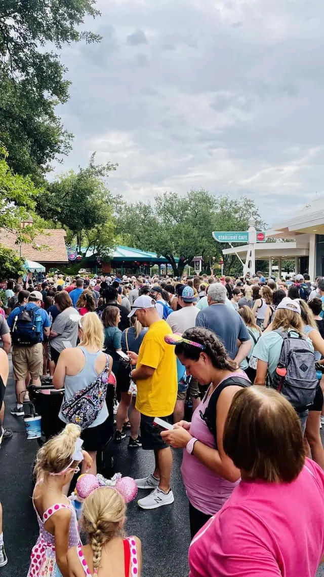
As I mentioned in my last update, the Martin Luther King, Jr. Holiday Weekend is a popular weekend to visit Walt Disney World for many guests. We expect crowd levels to increase for Saturday, Sunday, and the holiday on Monday.
A subscription to Character Locator can help you in planning and navigating these increased crowds, along with help in utilizing the new Genie service (and help you save money).
Updated Weather Forecast Through MLK Holiday

Since my last update we have a few changes in the forecast for this weekend. A low pressure system diving out of the Tennessee River Valley will become bring a relatively potent cold front through Florida on Sunday. Initially this system looked weaker, but computer model guidance has come into better agreement on a stronger low pressure system.
This storm system will eventually bring heavy snows Sunday night and Monday to inland areas of the Mid Atlantic and Northeast while the I-95 big cities should see a mix of snow and rain.
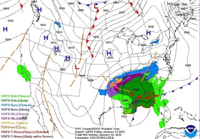
Back to Florida weather, pictured below is the expected surface map at 8:00pm Saturday night. You can see the Low over over MS/AL and the cold front approaching Florida. In addition, as you will see in my forecast at the end of the post, winds ahead of and behind the cold front will be higher than I originally thought bringing breezy weather to Central Florida.

Severe Weather Chances Sunday
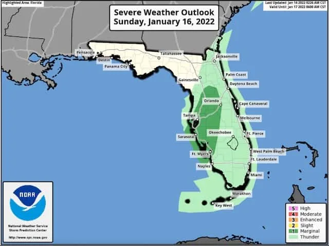
With a stronger system and cold front, this did increase the thunderstorm and severe weather potential. Pictured below, you can see much of the I-4 corridor from Tampa to Orlando is included in the Marginal Risk for severe weather.

The highest chances for severe weather look to be Sunday late morning/early afternoon as a line of thunderstorms move across Central Florida. Be sure to keep an eye out and follow any warnings or directions from cast members.
Heavy downpours are possible Sunday, especially during any thunderstorms. The good news is that we should see improving conditions by late afternoon Sunday.
Here is the forecast for the rest of this week through MLK Jr Holiday:
Friday, January 14th: Sunny, High 70. Winds NW 5-10mph.
Saturday, January 15th: Sunny, increasing clouds late, High 73. Scattered showers possible Saturday night, becoming breezy. Winds SW 10-15mph.
Sunday, January 16th: Scattered showers and thunderstorms with heavy downpours, breezy, High 68. Winds SW 15-25mph
Monday January 17th, Martin Luther King, Jr. Day: Mostly Sunny, cooler & breezy, High 62. Winds W 10-20mph
Tuesday, January 18th: Mostly sunny, High 61. Winds NW 5-10mph.

Looking ahead after the cool down behind this system things should warm up quickly to the 70’s by the middle of next week. If you are headed to the parks, enjoy! Just keep an eye on things Sunday.
Are you headed to Disney World this weekend? What are you excited about most? Let us know in the comments below or on Facebook!
Discover more from KennythePirate.com
Subscribe to get the latest posts sent to your email.


What do you think?